amateur radio
compass
emergency communication
ham radio
outdoor
radio communications
tips and tricks
accuracy, ad hoc networking, adjacent channel power, ALARA, Allan variance, alternate channel power, AM, amateur radio, amateur radio equipment, amplitude modulation, amplitude shift keying, AMSAT, antenna, antenna alignment, antenna analysis, antenna gain, antenna installation, antenna modeling, antenna pointing, antenna tuner, APRS, ARDF, ARES, ARRL, as low as reasonably achievable, ASK, atmospheric conditions, aurora, automotive interference, azimuth, backpacking radio, balun, band conditions, band plan, bandwidth, baseband, baseplate compass, BCI, beam antenna, beam heading, beamwidth, bearing, BladeRF, broadcast interference, Brunton, calibration, Cammenga, camping radio, cancer, cataracts, CDMA, climate, close in phase noise, coax, cochlear implant, code division multiple access, cognitive radio, compass, computer interference, contesting, continuous wave, coordination, crystal oscillator, cw, declination adjustment, deviation, digital compass, digital modes, digital signal processing, dipole antenna, direct sampling, direct sequence, direction finding, disaster communications, double sideband, DSB, Durability, dx, dxing, dynamic range, electric field strength, electromagnetic compatibility, electromagnetic interference, electronics, EMC, eme, emergency communications, emergency networking, emergency preparedness, emergency response, emergency services, EMI, emission bandwidth, end fed antenna, far field, far out phase noise, FCC, FDMA, feedline, field day, field operations, field strength, first responder, FM, FM satellite, fox hunting, frequency accuracy, frequency agility, frequency allocation, frequency counter, frequency division multiple access, frequency hopping, frequency modulation, frequency resolution, frequency shift keying, frequency stability, frequency synthesis, front to back ratio, fsk, FT4, ft8, garmin, geomagnetic activity, GNU Radio, gps, GPS disciplined oscillator, GPSDO, great circle bearing, hackrf, ham gear, ham operator, ham radio, harmonics, HDSDR, hearing aid, HF radio, hiking radio, I Q data, IARU, image rejection, impedance matching, industrial interference, interference hunting, interference mitigation, intermediate frequency, intermodulation, interoperability, ionosphere, ITU, JS8, LED interference, lensatic compass, linear transponder, local oscillator, loop antenna, low power, magnetic declination, magnetic field strength, magnetic loop, magnetic north, magnetic variation, maximum permissible exposure, measurement, medical device interference, mesh networking, meteor scatter, meteorology, military compass, military grade, military radio, mixer, mobile operations, modulation index, moonbounce, morse code, MPE, narrow band FM, navigation, navigation tools, near field, necessary bandwidth, network analyzer, non ionizing radiation, non thermal effects, occupied bandwidth, ocxo, ofdm, on off keying, OOK, orienteering, orienteering compass, orthogonal frequency division multiplexing, out of band emissions, outdoor equipment, outdoor gear, outdoor radio, pacemaker, packet radio, performance, phase locked loop, phase modulation, phase noise, phase reciprocal mixing, phase shift keying, PLL, PM, portable antenna, portable operations, POTA, power density, power line noise, power meter, precautionary principle, precision, precision navigation, professional grade, propagation, protocols, PSK, psk31, public safety radio, public service, QAM, qrp, QSO, quadrature amplitude modulation, quadrature sampling, RACES, radio contest, radio direction finding, radio equipment, radio frequency interference, radio hobby, radio operator, radio propagation, radio test equipment, radiotelegraphy, radiotelephony, random wire, receiver performance, reciprocal mixing, red pitaya, reliability, Repeater, RF burns, RF exposure, RF front end, RF safety, RFI, RFI hunting, rotator, RTL SDR, rubidium standard, SAR, satellite communication, sdr, SDR Sharp, search and rescue, selectivity, sensitivity, shock resistant, signal generator, signal strength, signal to noise ratio, Silva, single sideband, site survey, skip, SKYWARN, Smith chart, SNR, software defined radio, software radio, solar activity, sota, space weather, specific absorption rate, specifications, spectrum analyzer, sporadic E, spread spectrum, spurious emissions, spurious signals, SSB, standards, standing wave ratio, sterility, storm spotting, surveyor grade, survival gear, suunto, switching power supply, swr, SWR meter, tactical gear, tactical networking, TCXO, TDMA, telegraph, television interference, thermal effects, third order intercept, time division multiple access, tolerance, topographic maps, transceiver, transmission line, transmitter hunting, transmitter performance, triangulation, true north, TVI, two way radio, UHF radio, USRP, vector network analyzer, vertical antenna, VHF radio, volunteer, waterproof, weak signal, weather, weather resistance, wide band FM, WINMR, wire antenna, wireless communication, yagi antenna
9M2PJU
0 Comments
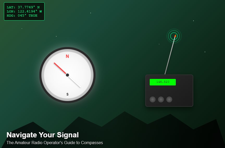
The Amateur Radio Operator’s Guide to Compasses: Your Silent Signal Companion
In the world of amateur radio, we often become captivated by the latest transceivers, cutting-edge antenna designs, and sophisticated digital modes. While these technological marvels rightfully deserve our attention, there’s a humble yet indispensable tool that many operators overlook: the compass. This simple navigational instrument has been guiding explorers, soldiers, and adventurers for centuries, and it remains just as relevant for today’s amateur radio operator.
Whether you’re a casual weekend warrior setting up for a Parks on the Air activation, a dedicated DXer optimizing your beam antenna, or an emergency communicator preparing for disaster response, a quality compass can be the difference between successful communication and frustrating silence. In this comprehensive guide, we’ll explore everything you need to know about compasses in amateur radio, from basic principles to advanced applications.
🧭 Understanding How Compasses Work: The Science Behind the Magic
The Fundamentals of Magnetic Navigation
At its core, a traditional compass operates on one of nature’s most fundamental forces: magnetism. The Earth itself acts as a giant magnet, with magnetic field lines flowing from the magnetic south pole to the magnetic north pole. The magnetized needle in your compass aligns itself with these invisible field lines, creating a reliable reference point that has guided humanity for over a thousand years.
However, there’s an important distinction that every amateur radio operator should understand: magnetic north is not the same as true north. True north points to the geographic North Pole, while magnetic north points to the magnetic north pole, which is currently located in northern Canada and moves approximately 25 miles per year. This difference, called magnetic declination or variation, varies depending on your location and can range from 0° to over 20° in some areas.
Types of Compasses and Their Applications
Modern compasses come in several distinct varieties, each optimized for specific use cases:
Magnetic Compasses (Traditional Analog) These are the classic liquid-filled compasses with a floating needle. They’re simple, reliable, and require no power source. The liquid dampening prevents excessive needle oscillation and provides smooth, stable readings even in windy conditions.
Lensatic Compasses (Military-Style Precision) Originally developed for military use, these compasses feature a hinged cover with a sighting wire and a lens for precise bearing measurements. They’re built to withstand extreme conditions and often include tritium illumination for night use.
Baseplate Compasses (Orienteering Style) Popular among hikers and orienteers, these compasses are mounted on a clear plastic baseplate with rulers and scales. They’re designed for map work and route planning, making them excellent for antenna site surveys and field operations.
Digital Compasses and Electronic Solutions Modern smartphones, GPS units, and dedicated electronic compasses use magnetometers and sometimes gyroscopes to determine direction. While convenient, they require power and can be affected by electronic interference from radio equipment.
Mirror Sighting Compasses These combine the accuracy of lensatic compasses with the map-work capabilities of baseplate compasses. The mirror allows for precise bearing shots while also serving as an emergency signaling device.
📡 Why Every Amateur Radio Operator Needs a Compass
1. Directional Antenna Optimization: Getting Every dB
For amateur radio operators using directional antennas, precise alignment isn’t just helpful—it’s absolutely critical. Whether you’re operating a simple 2-meter Yagi or a massive HF beam array, pointing your antenna in the right direction can mean the difference between successful communication and complete failure.
Consider this scenario: you’re trying to work a rare DX station in Japan from your location in the eastern United States. Your beam antenna has a 3dB beamwidth of about 60°, which might seem forgiving, but being off by just 10-15° could cost you 1-2 dB of signal strength. In weak signal conditions, this seemingly small error could make your signal unreadable at the receiving end.
Professional antenna installations often require pointing accuracy within 1-2°, and while amateur installations might not need to be quite that precise, even casual operators can benefit from improved accuracy. A good compass allows you to:
- Accurately determine the bearing to your target location
- Properly align rotatable beam antennas
- Optimize fixed antenna installations during the planning phase
- Troubleshoot propagation issues by verifying antenna pointing
2. Portable and Emergency Operations: Navigation in the Field
Amateur radio’s strength lies partly in its portability and usefulness during emergencies. When you’re operating away from your comfortable home station—whether for SOTA (Summits on the Air), POTA (Parks on the Air), Field Day, or emergency response—a compass becomes an essential tool for several reasons:
Site Selection and Setup When arriving at a new operating location, understanding the terrain’s orientation helps you make informed decisions about antenna placement. If you know that the nearest repeater or your target contact area lies to the northeast, you can position your antenna and operating position accordingly.
Navigation and Safety In remote locations, especially during SOTA activations on mountain peaks, weather can change rapidly and visibility can become severely limited. Your GPS might fail, or its battery might die. A compass provides a reliable backup navigation method that could literally save your life.
Coordination with Other Operators When working with multiple operators in the field, being able to communicate precise bearings helps coordinate activities. “The noise is coming from 135°” is much more useful than “the noise is coming from over there somewhere.”
3. Amateur Radio Direction Finding (ARDF): The Art of the Hunt
Amateur Radio Direction Finding, also known as “fox hunting” or “transmitter hunting,” is both a competitive sport and a practical skill. Participants use specialized equipment and techniques to locate hidden transmitters, and a compass is absolutely essential for this activity.
Competition Fox Hunting In ARDF competitions, participants must locate multiple hidden transmitters in a wooded area using only their radio equipment and navigation skills. Success requires the ability to take accurate bearings from multiple locations and triangulate the transmitter’s position. Even small bearing errors can lead you miles off course.
Practical RFI Hunting When tracking down interference sources in your neighborhood, the same principles apply. By taking bearings from multiple locations and plotting them on a map, you can narrow down the interference source’s location before beginning detailed investigation.
Search and Rescue Applications Emergency responders sometimes use ARDF techniques to locate emergency beacons or lost persons carrying radios. The ability to quickly and accurately determine bearing to a signal source can be crucial in life-or-death situations.
4. HF Propagation and DXing: Understanding the Path
For HF operators, especially those interested in DX (long-distance) communication, understanding signal paths and propagation is crucial. A compass helps you:
Great Circle Bearing Calculations The shortest path between two points on Earth’s surface follows a great circle route, which often differs significantly from what appears shortest on a flat map. Knowing the great circle bearing to your target helps optimize antenna pointing for maximum signal strength.
Propagation Prediction and Analysis Understanding where your signal is going helps interpret propagation predictions and band conditions. If propagation to Europe is good but you’re hearing nothing on 20 meters, checking your antenna bearing might reveal that it’s pointed toward the Pacific instead.
Multi-Path Analysis Some HF signals can arrive via multiple propagation paths simultaneously. Understanding the geometry involved helps explain why signals sometimes sound distorted or have flutter.
🎯 Advanced Compass Applications in Amateur Radio
Magnetic Declination: The Critical Adjustment
One of the most important concepts for amateur radio operators to understand is magnetic declination. This is the angular difference between magnetic north (where your compass points) and true north (the actual direction to the North Pole). Declination varies significantly based on your location and changes slowly over time.
For example, if you’re operating from New York City, your magnetic declination is approximately 13° West, meaning your compass points 13° west of true north. If you’re trying to point your antenna toward Europe using a bearing calculated from true north, you’ll need to add 13° to that bearing when using your compass.
Most quality compasses include adjustable declination correction, allowing you to set the compass to show true bearings directly. This eliminates the need for mental math in the field and reduces the chance of errors.
Site Surveys and Antenna Planning
Before installing any significant antenna system, conducting a proper site survey is essential. A compass plays several important roles in this process:
Obstacle Analysis By taking bearings to various obstacles (trees, buildings, power lines), you can create accurate maps showing where antenna placement might be problematic. This is especially important when planning directional antennas that need clear paths in specific directions.
Ground Slope Analysis Many compasses include clinometers (inclinometers) that measure ground slope. This information is crucial when planning guy wires for towers or determining optimal locations for ground plane antennas.
Property Line Verification When installing antennas near property boundaries, accurate bearing measurements help ensure compliance with local setback requirements and maintain good neighbor relations.
Integration with Modern Technology
While traditional compasses remain valuable, they work best when integrated with modern technology:
GPS and Mapping Software Combining compass bearings with GPS coordinates allows for precise plotting on digital maps. Many mapping applications can display both magnetic and true bearings, making it easier to correlate compass readings with digital information.
Smartphone Apps While not replacements for dedicated compasses, smartphone compass apps can be useful for quick checks and preliminary planning. However, be aware that phones can be affected by magnetic interference from radio equipment.
APRS Integration For operators using APRS (Automatic Packet Reporting System), accurate position and bearing information can be crucial for effective communication and coordination with other stations.
🏕️ Comprehensive Compass Recommendations for Amateur Radio
Choosing the right compass depends on your specific needs, operating style, and budget. Here are detailed recommendations across various categories:
Premium Professional Compasses
🔹 Suunto MC-2G Global Compass Price Range: $80-120
This is often considered the gold standard for serious outdoor professionals. The MC-2G features a global needle that works accurately anywhere on Earth, eliminating the need for different compasses in different geographic zones. Key features include:
- Adjustable declination correction with easy-to-use tool
- Mirror for precise bearing shots and emergency signaling
- Clinometer for measuring slope angles
- Luminous markings for low-light conditions
- Sapphire jewel bearing for long-term accuracy
- Temperature compensation for consistent readings
Best for: Serious SOTA/POTA operators, emergency communicators, and operators who travel internationally.
🔹 Brunton TruArc 20 Price Range: $70-100
Designed for professional surveyors and outdoor guides, this compass offers exceptional accuracy and durability. Features include:
- Global needle system for worldwide use
- Tool-free declination adjustment
- Built-in clinometer with percentage and degree scales
- Rare earth magnet for fast needle settling
- Sapphire jewel bearing
- Waterproof construction
Best for: ARDF competitors, antenna installers, and operators requiring surveyor-grade accuracy.
Military-Grade Durability
🔹 Cammenga 27CS Lensatic Compass (Tritium) Price Range: $120-180
This is the same compass used by the U.S. military and represents the pinnacle of mechanical compass durability. Key features:
- Self-luminous tritium dial markings (no batteries required)
- Waterproof to considerable depths
- Shock-resistant construction
- Copper induction damping for steady needle
- Magnifying lens for precise readings
- Lifetime warranty
Best for: Emergency responders, military operators, and anyone requiring maximum durability.
🔹 Silva Ranger 2.0 Price Range: $50-80
A excellent compromise between professional features and reasonable cost. This compass has been trusted by military forces worldwide:
- High-quality mirror sighting system
- Built-in inclinometer
- Adjustable declination
- Robust construction suitable for harsh conditions
- Luminous markings
- Lanyard included
Best for: Field Day operations, emergency kits, and general outdoor use.
Budget-Friendly Options
🔹 Suunto A-10 Recreational Compass Price Range: $20-35
While basic, this compass offers surprising accuracy for its price point:
- Simple, reliable operation
- Fixed declination scale
- Luminous markings
- Lightweight and compact
- Perfect for beginners
Best for: New operators, backup compass, or casual use.
🔹 Coghlan’s Pin-On Ball Compass Price Range: $8-15
Ultra-compact option for minimal weight situations:
- Weighs less than 0.5 ounces
- Pin-on design for easy attachment
- Surprisingly accurate for its size
- Liquid-filled for stability
Best for: Ultralight SOTA operations or emergency kit addition.
Electronic and Digital Options
🔹 Garmin Foretrex 701 Ballistic Edition Price Range: $400-500
This wrist-mounted GPS unit includes a high-quality digital compass:
- 3-axis compass with tilt compensation
- GPS and GLONASS compatibility
- APRS messaging capability
- Night vision compatibility
- Extremely rugged construction
- Long battery life
Best for: Technical operators, SAR teams, and military communications.
🔹 Garmin eTrex 32x Price Range: $200-250
Handheld GPS with excellent compass capabilities:
- 3-axis tilt-compensated compass
- Preloaded TopoActive maps
- Paperless geocaching support
- 25-hour battery life
- Rugged, waterproof design
Best for: SOTA/POTA operators who want GPS and compass in one unit.
🔧 Practical Tips for Using Compasses in Amateur Radio
Avoiding Common Mistakes
Magnetic Interference Radio equipment can significantly affect compass accuracy. Keep your compass at least 3-6 feet away from:
- Transceivers and power supplies
- Metal antenna elements
- Vehicle engines and electrical systems
- Large metal structures
Reading Errors Always ensure the compass is level when taking readings. Tilt can introduce significant errors, especially with basic compasses.
Declination Confusion Always verify whether your calculations require magnetic or true bearings, and adjust accordingly.
Advanced Techniques
Triangulation for ARDF Take bearings from at least three different locations to accurately pinpoint a transmitter’s location. The intersection of bearing lines on your map shows the target location.
Back-Bearings for Navigation When hiking to a remote operating location, periodically take back-bearings to known landmarks. This helps ensure you can find your way back if conditions deteriorate.
Bearing Averaging In windy conditions or when maximum accuracy is needed, take multiple readings and average them for better precision.
📚 Integration with Maps and Planning Tools
Using Topographic Maps
Understanding how to use your compass with topographic maps opens up advanced possibilities:
Contour Line Analysis Topographic maps show elevation changes through contour lines. This information helps predict line-of-sight paths for VHF/UHF communications and identifies potential RF reflection points.
UTM Grid References Many modern maps include UTM (Universal Transverse Mercator) grid systems that work well with GPS coordinates and compass bearings.
Digital Map Integration
Google Earth and Mapping Software Most mapping applications can display magnetic declination information and show both true and magnetic bearings. This makes it easy to plan antenna orientations before arriving at your operating location.
Propagation Prediction Tools When using HF propagation prediction software, accurate bearing information helps interpret predictions and optimize antenna pointing.
🚨 Emergency Preparedness and Compass Use
Building Emergency Kits
Every amateur radio emergency kit should include a quality compass. Consider these factors:
Redundancy Include both a primary compass and a backup. Different types (mechanical and electronic) provide redundancy against different failure modes.
Waterproofing Ensure your compass can survive harsh weather conditions. Many emergencies occur during severe weather when navigation becomes most challenging.
Lighting Choose compasses with luminous markings or include a small flashlight or red LED light for night use.
Search and Rescue Applications
Amateur radio operators often support search and rescue operations. Compass skills become critical in these situations:
Grid Search Coordination SAR operations often use grid search patterns that require precise navigation. Being able to follow and report accurate bearings is essential.
Resource Location When coordinating multiple search teams, being able to provide accurate directions to resources (water, shelters, hazards) using compass bearings improves efficiency and safety.
🌐 International Considerations
Operating Abroad
If you travel internationally with your amateur radio equipment, consider these compass-related factors:
Magnetic Declination Variations Declination varies significantly around the world. Some areas have declination exceeding 30°, making accurate correction essential.
Global vs. Regional Compasses Some compasses are designed to work only in specific magnetic zones. Global compasses work everywhere but cost more.
Cultural and Legal Considerations Some countries have restrictions on navigation equipment. Research local regulations before traveling with compasses or GPS units.
🔬 The Science of Compass Accuracy
Understanding Limitations
Even the best compasses have limitations that amateur radio operators should understand:
Temperature Effects Extreme temperatures can affect compass accuracy. Most quality compasses include temperature compensation, but very cheap models may be significantly affected.
Magnetic Dip Near the magnetic poles, compass needles tend to point downward as well as northward. This “magnetic dip” can affect accuracy and is why some compasses are designed for specific geographic zones.
Local Magnetic Anomalies Some geographic areas have local magnetic anomalies caused by iron ore deposits or other geological features. These can cause compass errors of several degrees.
Calibration and Maintenance
Regular Calibration Checks Periodically verify your compass accuracy against known bearings. Sunrise and sunset directions can provide approximate east-west references.
Bubble Inspection Liquid-filled compasses sometimes develop bubbles over time. Small bubbles usually don’t affect accuracy, but large bubbles may indicate seal failure.
📈 Future Technology and Compass Evolution
Emerging Technologies
MEMS Sensors Micro-electromechanical systems (MEMS) are making digital compasses smaller, more accurate, and less power-hungry. These sensors are now found in most smartphones and GPS units.
Satellite-Based Systems While GPS provides position information, emerging satellite systems may eventually provide precise heading information without relying on magnetic fields.
Integration with SDR Software-defined radio (SDR) technology might eventually integrate direction-finding capabilities directly into transceivers, potentially reducing the need for separate compass equipment.
🎯 Conclusion: Your Path to Better Communications
In our digital age, it’s easy to overlook simple tools like compasses in favor of high-tech solutions. However, as any experienced amateur radio operator will tell you, the best tools are often the simplest ones. A compass doesn’t need batteries, won’t crash, and works reliably in conditions that would disable electronic alternatives.
Whether you’re a new operator setting up your first antenna or an experienced DXer chasing rare contacts, investing in a quality compass will pay dividends in improved communications, enhanced safety, and greater confidence in your operating abilities. The compass won’t make you a better operator overnight, but it will give you the tools to make informed decisions about antenna pointing, site selection, and navigation.
Remember that like any tool, a compass is only as good as the operator using it. Take time to learn proper compass techniques, understand magnetic declination in your area, and practice using your compass in various conditions. The investment in time and money will reward you with years of improved amateur radio experiences.
From casual weekend operations to emergency communications, from competitive ARDF to serious DXing, a compass remains one of the most versatile and valuable tools in the amateur radio toolkit. Don’t let its simplicity fool you—in the hands of a knowledgeable operator, a compass can be the key to unlocking better communications and safer operations.
So the next time you’re packing your gear bag, make sure that humble compass has a place alongside your sophisticated radio equipment. Your future contacts will thank you for the stronger signals, and you’ll appreciate the confidence that comes from knowing exactly where you’re pointing your antenna and how to find your way home.
What’s your experience with compasses in amateur radio? Have you found particular models or techniques especially useful? Share your experiences with the amateur radio community—we all learn from each other’s successes and challenges.
Remember: The best compass is the one you have with you and know how to use. Start with a basic model, learn the fundamentals, and upgrade as your needs and experience grow.


Post Comment