amateur radio
APRS
automatic packet reporting system
ham radio
radio amatur
amateur radio, APRS, automatic packet reporting system, Bob Bruninga, Crisis Response, Digital Ham Radio, disaster preparedness, EmComm, emergency communications, Emergency Management, GPS Tracking, ham radio, off-grid communication, packet radio, Public Safety Technology, radio technology, search and rescue, survival gear, tactical communications, telemetry
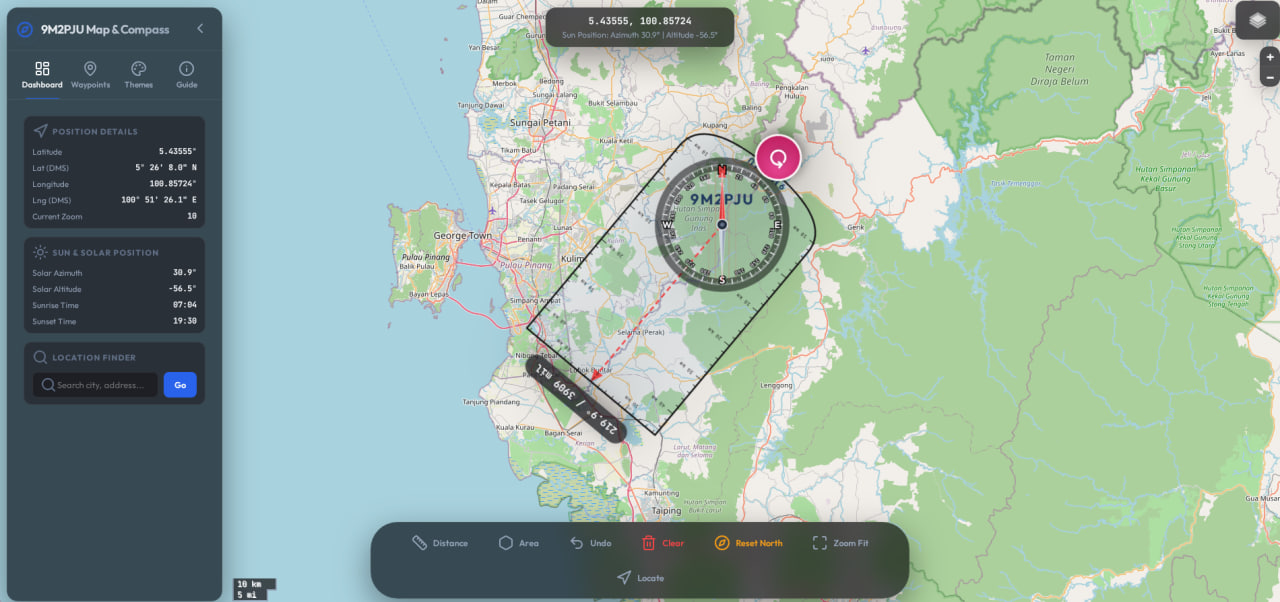
9M2PJU
0 Comments
The Silent Sentinel: Why APRS is the Ultimate Digital Lifeline When the Grid Fails
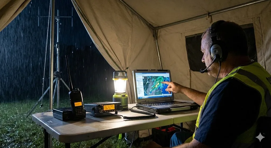
Imagine a scenario: A hurricane has made landfall, or a massive wildfire has severed fiber optic lines. The cellular network is overloaded and eventually goes dark. The internet is gone. In this digital blackout, how do emergency responders track their assets? How do families send “I’m safe” messages?
For Amateur Radio operators, the answer often lies in a series of digital “chirps” known as APRS (Automatic Packet Reporting System). While often mistaken as just a “vehicle tracker,” APRS is actually one of the most resilient, tactical, and vital tools in the emergency communications (EmComm) arsenal.
In this post, we’ll dive deep into the history of APRS, how it saves lives during crises, and why its continuous usage today is critical for future readiness.
What is APRS? (It’s More Than Just GPS)
Before we discuss disaster scenarios, we must understand the tool. APRS is a digital communications protocol used by amateur radio operators to exchange real-time tactical information.
Unlike voice communications, which are fleeting and require you to be listening at the exact right moment, APRS is visual and persistent. It uses packet radio to transmit data—coordinates, weather telemetry, text messages, and status objects—over radio waves (usually on the 2 meter band)
A Legacy of Innovation: The History of APRS
To understand the philosophy of APRS, we have to look at its creator, the late Bob Bruninga (WB4APR).
In the early 1980s and 90s, Bob didn’t set out to build a vehicle tracking system. He wanted to solve a “local tactical” problem. In an emergency operations center, voice channels were cluttered with people asking, “What is your location?” and “What is the status of the shelter?”
Bob developed APRS to move that data off the voice channel. His vision was a real-time dashboard for local information. He famously insisted that APRS stands for Automatic Packet Reporting System, emphasizing that it is not just for Position reporting, but for Packet reporting of all kinds of tactical data.
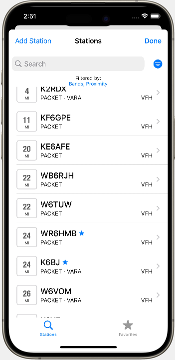
From its humble beginnings on Commodore 64s and TNCs (Terminal Node Controllers), APRS has evolved into a global network supported by satellites, internet gateways (IGates), and handheld radios.
3 Critical Usages of APRS During Emergencies
When disaster strikes, confusion is the enemy. APRS cuts through the fog of war in three distinct ways.
1. Tactical Situational Awareness (Asset Tracking)
In a search and rescue (SAR) operation or wildfire response, the Incident Commander needs to know exactly where their teams are.
- The Problem: Relying on voice reports (“Command, I am at the corner of 5th and Main”) takes up valuable airtime and is prone to error.
- The APRS Solution: Responders carrying handhelds or driving trucks equipped with APRS trackers automatically beacon their position every few minutes. The Incident Commander can look at a map screen and see the real-time movement of every unit.
- Why it matters: This creates a “God’s eye view” of the battlefield without a single word being spoken, leaving voice frequencies open for urgent traffic.
2. The “Last Mile” Messaging Service
What happens when you need to send a supply list or a welfare check, but the internet is down? APRS has a built-in text messaging capability.
- Station-to-Station: You can send short text messages directly from radio to radio, completely independent of the internet.
- The SMS/Email Gateway: Even if the local internet is down, if your radio packet can reach a high-altitude repeater or an IGate 50 miles away that does have power, that IGate can route your message to the global internet. This allows a ham radio operator in a disaster zone to send an SMS to a family member’s cell phone or an email to a relief agency.
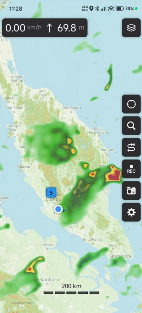
3. Hyper-Local Weather Intelligence
Natural disasters are often weather-dependent. National radar gives a broad picture, but micro-climates matter during floods and fires.
- Weather Telemetry: Many hams connect their home weather stations to APRS. These stations autonomously beacon wind speed, rainfall, and barometric pressure.
- Crisis Application: During a flash flood, an emergency coordinator can monitor APRS weather packets from the specific valley where the water is rising, getting ground-truth data that might differ from the news report. This data often feeds directly into the National Weather Service via the CWOP (Citizen Weather Observer Program).
Continuous Usage: Keeping the Network Alive
One of the unique aspects of APRS is that it relies on a “mesh” of volunteer digipeaters (digital repeaters) and IGates. If hams stopped using APRS, the network would decay. Therefore, everyday usage is actually a form of preparedness.
- The “Always-On” Global Net: By tracking their daily commutes or hiking trips (SOTA – Summits on the Air), hams ensure that digipeaters are functional and coverage maps are accurate.
- Space Communications: APRS is a primary mode of communication through the International Space Station (ISS) and various CubeSats. Hams practice bouncing packets off satellites, a skill that becomes crucial if terrestrial repeaters fail.
- Public Service Events: Hams use APRS to track runners in marathons or support vehicles in bike races. These “planned disasters” are the perfect training ground for the real thing.
Conclusion: The Visual Language of Survival
In an age of 5G and Starlink, it is easy to dismiss a 1200-baud packet radio protocol as obsolete. But fragility is the price of complexity. Cellular networks are fragile; the internet is fragile.
APRS is robust. It is decentralized, operates on simple hardware, and provides the one thing most critical in a crisis: Truth. The truth of where people are, what the weather is doing, and who needs help.
For the amateur radio operator, equipping your station with APRS isn’t just a fun hobby project—it is a commitment to being the eyes and ears of your community when the screen goes dark.
Ready to get started?
- Hardware: Look into easy-to-use trackers like the Mobilinkd TNC or radios with built-in APRS like the Yaesu FT-5D or Kenwood TH-D74.
- Software: Download APRSdroid (Android) or aprs.fi (iOS) to see the network in action right now.


Post Comment