Understanding Kertau 1948 and the Science of Geodesy
What is Kertau 1948?
Kertau 1948, also known as Kertau (RSO) 1948, is a geodetic datum that was historically used in Malaysia. A geodetic datum is a coordinate system that includes a model of the Earth to provide accurate positions on its surface. Established during the British colonial period, Kertau 1948 is based on the Modified Everest ellipsoid and served as the primary reference frame for mapping and surveying in Malaysia for many years.
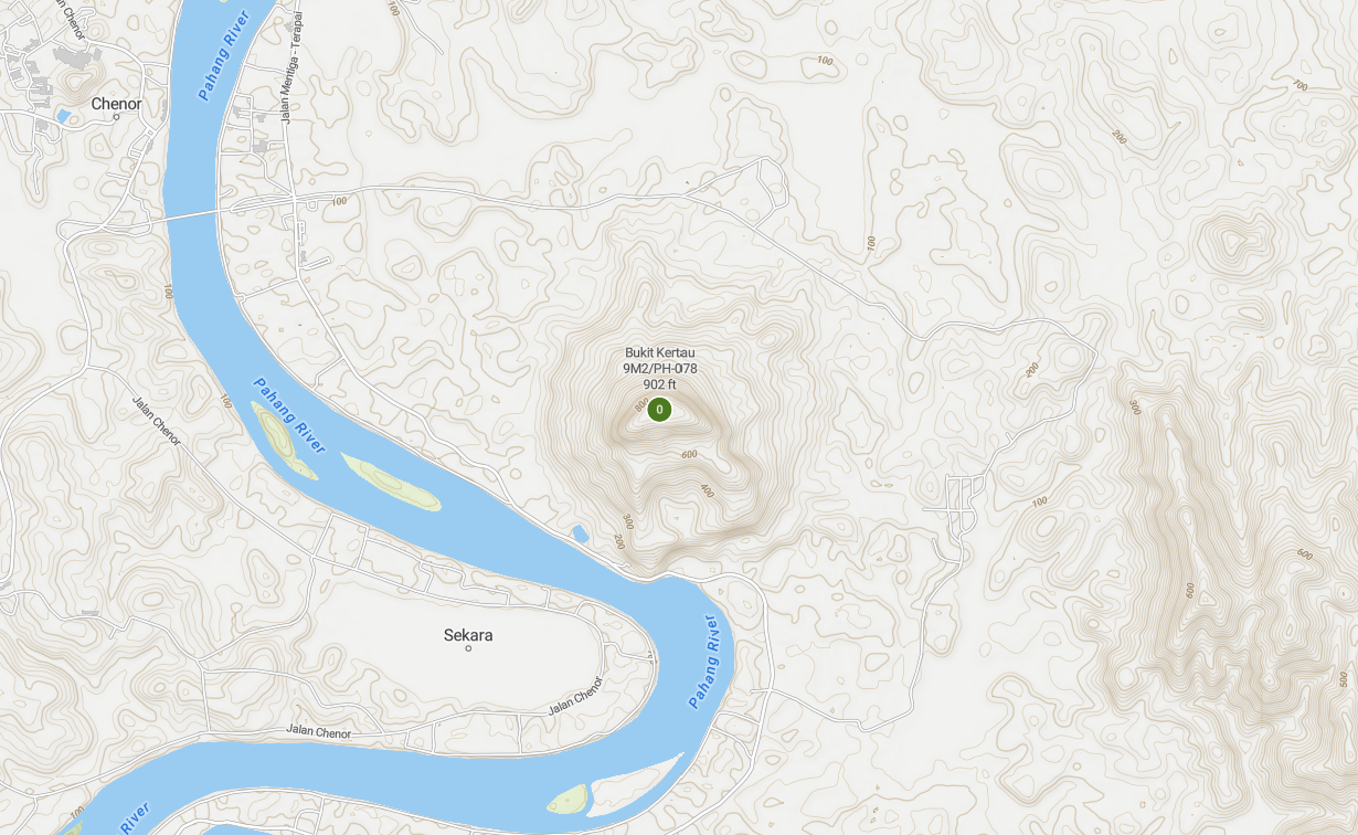
The Significance of Kertau Hill
Kertau Hill, or Bukit Kertau, is a hill located in Malaysia that played a crucial role in this geodetic system. It served as the origin point for the Kertau 1948 datum, meaning its position was used as the fundamental reference or “datum point” for mapping and surveying under this system. The selection of Kertau Hill was due to its prominent location and suitability for astronomical observations and triangulation, essential for establishing an accurate and reliable geodetic framework.
The Transition to Modern Systems
The Kertau 1948 datum was used for various applications, including land surveying, mapping, and infrastructure development across Malaysia. Although it has largely been replaced by more modern systems like the Geocentric Datum of Malaysia 2000 (GDM2000), which aligns with global satellite-based systems such as the World Geodetic System 1984 (WGS84), its historical significance remains notable.
Understanding Geodesy
Geodesy, or geodetics, is the branch of science dedicated to the measurement and understanding of the Earth’s shape, orientation, and gravity field. It involves the study of the Earth’s dimensions and shape, as well as the determination of precise locations on its surface.
Key aspects of geodesy include:
- Determining the Earth’s Shape: Measuring and defining the Earth’s actual shape, which is not a perfect sphere but more of an ellipsoid flattened at the poles.
- Measuring Earth’s Gravity: Studying and measuring the Earth’s gravity field to understand variations caused by differences in the density of materials within the Earth.
- Positioning: Establishing precise coordinates for locations on the Earth’s surface using techniques such as triangulation, trilateration, and global satellite navigation systems (like GPS).
Geodesy is fundamental for various applications, including mapping, navigation, and understanding tectonic movements. It helps us develop accurate models of the Earth, which are essential for everything from GPS technology to construction and environmental monitoring.
Conclusion
The Kertau 1948 datum and the science of geodesy highlight the importance of precise measurements and models in understanding and navigating our world. While modern systems have taken over, the historical foundations laid by systems like Kertau 1948 continue to be significant in the evolution of geodetic science and technology.


Post Comment