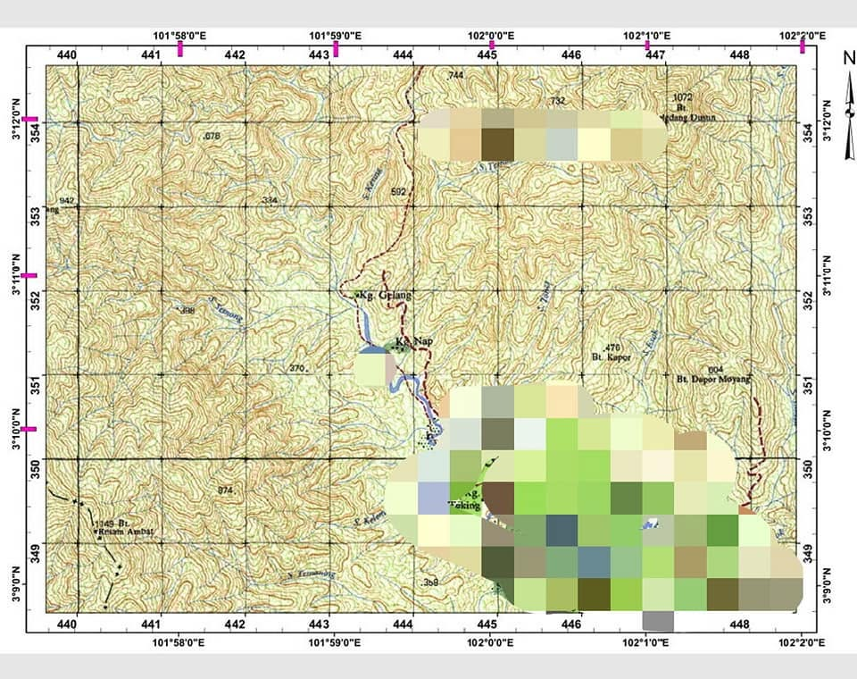
How to Read Latitude and Longitude on a Topographic Map
Topographic maps from JUPEM show coordinates like 101°59'0"E and 3°10'0"N along the border. Those are…
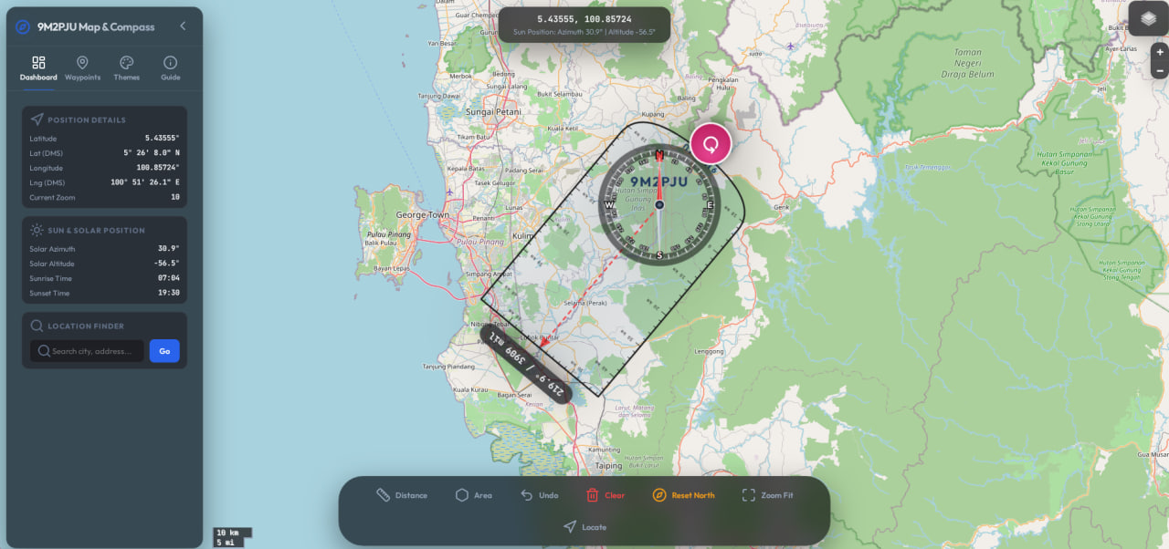
9M2PJU Map & Compass: The Navigation Tool Amateur Radio Operators Need
Navigation and position reporting form the backbone of effective amateur radio operations. Whether you're coordinating…
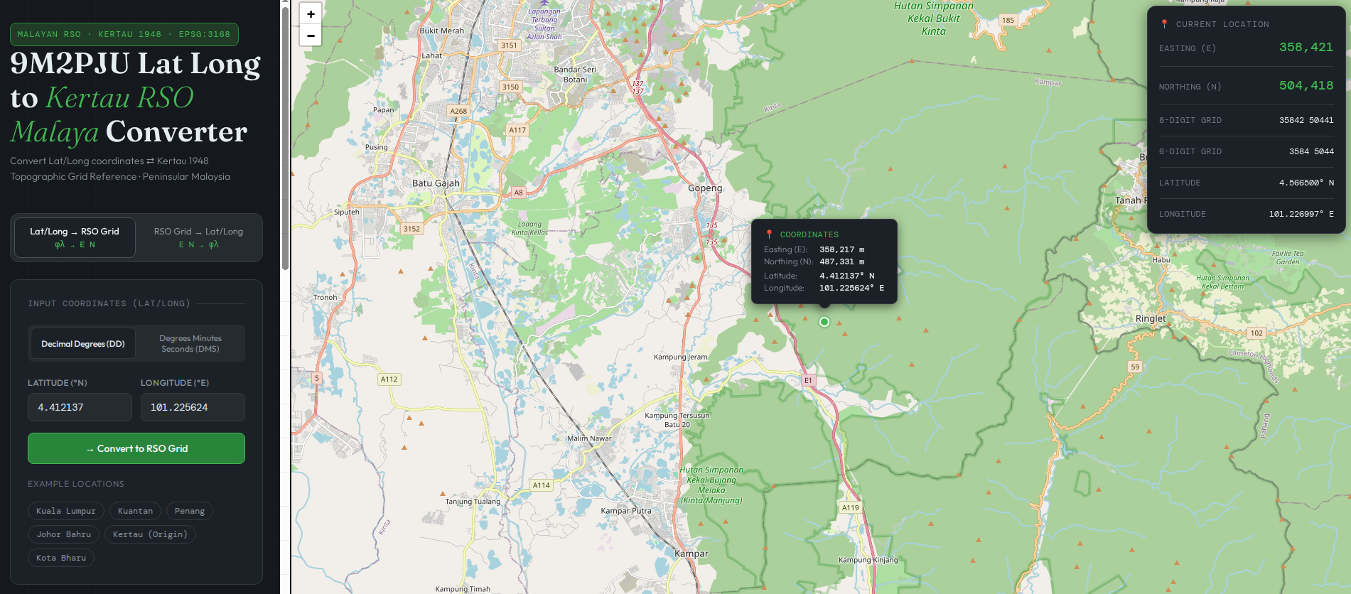
9M2PJU Lat Long to Kertau RSO Malaya Converter
If you work with mapping, emergency communications, forestry, or land surveying in Peninsular Malaysia, you…
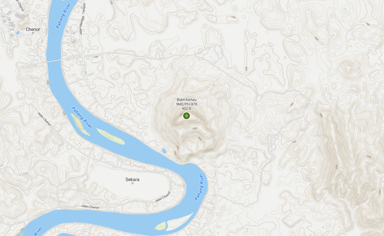
Understanding Kertau 1948 and the Science of Geodesy
What is Kertau 1948? Kertau 1948, also known as Kertau (RSO) 1948, is a geodetic…
9M2PJU Latest DXCC Map (April 2013)
p/s: not bad for a dipole only station.
Mobile GMaps – FREE Maps Application For Your Mobile Phones
Mobile GMaps is a FREE application that displays maps from Google Maps, Yahoo! Maps, Windows…
We-Travel – Free JavaME GPS Navigation Application For Java Enabled Mobile Phones
We-Travel is a free navigation software for java enabled mobile phones, based on map data…
TangoGPS – Free Map and GPS Software For Linux
tangogps is an easy to use, fast and lightweight mapping application for use with or…
World Ham Radio Callsign Map
World ham radio callsign map.