TailVision: Unfiltered Augmented Reality Flight Tracking on Android by ADS-B Exchange

Planespotters, aviation enthusiasts, and amateur radio operators frequently look up at a contrail and wonder what is flying overhead. For years, mobile flight-tracking apps solved this problem with a catch: commercial platforms routinely censor military flights, government transports, private corporate jets, and test aircraft to comply with corporate blocking requests.
TailVision by ADS-B Exchange (com.adsbexchange.tailvision) brings the raw, unfiltered data of the world’s largest community-fed flight tracking network into a fast, sensor-fused mobile app for Android. By combining real-time ADS-B radio data with your phone’s camera, GPS, and inertial sensors, TailVision lets you point your smartphone at the sky to instantly identify any transmitting aircraft overhead.
What Is TailVision?
TailVision is a native mobile flight-tracking and augmented reality application developed by ADS-B Exchange that overlays real-time, unfiltered aircraft telemetry onto a smartphone camera view and interactive radar map.
┌─────────────────────────────────────────────────────────────────────────┐
│                     TailVision System Architecture                      │
└─────────────────────────────────────────────────────────────────────────┘
                                     │
         ┌───────────────────────────┴───────────────────────────┐
         ▼                                                       ▼
┌──────────────────────────────────┐   ┌──────────────────────────────────┐
│      Transmitting Aircraft       │   │     Ground Receiver Network      │
│                                  │   │                                  │
│ • 1090 MHz Mode S Extended       │   │ • Community SDR Feeders (RTL-SDR)│
│   Squitter (1090ES / DO-260B)    │──►│ • Raspberry Pi / readsb / tar1090│
│ • 978 MHz UAT Transponders       │   │ • Multi-channel Ground Stations  │
│ • Mode A/C Radar Transponders    │   │ • GPS Timestamped Packet Feeds   │
└──────────────────────────────────┘   └──────────────────────────────────┘
                                                         │
                                                         ▼
                                       ┌──────────────────────────────────┐
                                       │    ADS-B Exchange Aggregator     │
                                       │                                  │
                                       │ • Zero Censorship / Zero LADD    │
                                       │ • MLAT (TDOA Multilateration)    │
                                       │ • Real-Time JSON Streaming API   │
                                       └──────────────────────────────────┘
                                                         │
                                                         ▼
┌─────────────────────────────────────────────────────────────────────────┐
│                   TailVision Android Mobile Client                      │
├────────────────────────────────────┬────────────────────────────────────┤
│ Augmented Reality (AR) HUD Mode    │ Tactical 2D Radar Display          │
│ • Camera Viewfinder Projection     │ • 30 NM (Guest) / 150 NM (Account) │
│ • 6-DoF Sensor Fusion (IMU/Compass)│ • Real-Time Aircraft Icons & Trails│
│ • Azimuth & Elevation Vectors      │ • Hex ICAO, Callsign, Speed, Alt   │
│ • Callsign, Altitude & Speed Tags  │ • Feeder Account Sync & Ad Removal │
└────────────────────────────────────┴────────────────────────────────────┘
Unlike conventional tracking tools that rely exclusively on traditional 2D map views, TailVision turns your phone into an interactive heads-up display (HUD). You point your camera lens at an airplane in the sky, and TailVision calculates its line-of-sight vector to paint an exact data tag on your screen, including the aircraft’s registration, flight number, altitude, ground speed, and origin-to-destination route.
Filtered vs Unfiltered Flight Data: Why It Matters
Most commercial flight-tracking platforms (such as Flightradar24 and FlightAware) operate under commercial agreements with civil aviation authorities and private fleet operators. When an owner registers under the FAA Limiting Aircraft Data Display (LADD) program, the Block Aircraft Registration Request (BARR) program, or the Privacy ICAO Address (PIA) scheme, those platforms remove the aircraft from their public maps.
┌─────────────────────────────────────────────────────────────────────────┐
│                 Data Pipeline: Filtered vs Unfiltered                   │
├──────────────────────┬────────────────────────┬─────────────────────────┤
│ Processing Stage     │ Commercial Trackers    │ ADS-B Exchange /        │
│                      │ (FR24, FlightAware)    │ TailVision App          │
├──────────────────────┼────────────────────────┼─────────────────────────┤
│ RF Signal Reception  │ 1090 MHz / 978 MHz     │ 1090 MHz / 978 MHz      │
│ Open Spectrum Feed   │ Raw RF Transmissions   │ Raw RF Transmissions    │
├──────────────────────┼────────────────────────┼─────────────────────────┤
│ Filtering Pipeline   │ Applied:               │ None:                   │
│                      │ • FAA LADD Blocklist   │ • 100% Unfiltered       │
│                      │ • Military Redactions  │ • Public Airwaves Rule  │
│                      │ • VIP / Executive Mask │ • Complete Transparency │
├──────────────────────┼────────────────────────┼─────────────────────────┤
│ Output to User       │ Censored / Incomplete  │ Full Raw Airspace View  │
└──────────────────────┴────────────────────────┴─────────────────────────┘
ADS-B Exchange was founded on a different principle: public radio transmissions over open airwaves should remain open and accessible to the public. Aircraft broadcast unencrypted signals on 1090 MHz and 978 MHz for flight safety and collision avoidance. ADS-B Exchange does not alter, block, or delete any aircraft data sent by its feeder network.
TailVision delivers this raw, unadulterated feed directly to mobile devices. When military tankers, surveillance drones, medical evacuation helicopters, or government transports fly through your local airspace, TailVision displays them with full telemetry.
Augmented Reality HUD: How Mobile Sensor Fusion Works
The headline feature of TailVision is its Augmented Reality Sky View. Pointing your mobile device at a tiny dot cruising at 38,000 feet and projecting an accurate label requires precise sensor fusion.
┌─────────────────────────────────────────────────────────────────────────┐
│                 TailVision Sensor Fusion Pipeline                       │
└─────────────────────────────────────────────────────────────────────────┘
   ┌──────────────────┐    ┌──────────────────┐    ┌──────────────────┐
   │ GPS Receiver     │    │ Magnetometer     │    │ 3-Axis Gyroscope │
   │ • Latitude       │    │ • Electronic     │    │ • Pitch / Roll   │
   │ • Longitude      │    │   Compass (Yaw)  │    │ • Device Tilt    │
   │ • GPS Altitude   │    │ • True North Ref │    │ • Angular Rate   │
   └────────┬─────────┘    └────────┬─────────┘    └────────┬─────────┘
            │                       │                       │
            └───────────────────────┼───────────────────────┘
                                    ▼
                 ┌─────────────────────────────────────┐
                 │     Local Observer Coordinate       │
                 │     Reference Frame (WGS84)         │
                 └──────────────────┬──────────────────┘
                                    │
                                    ▼
                 ┌─────────────────────────────────────┐
                 │  Aircraft 3D Spatial Vector Engine  │
                 │  • Azimuth Angle Calculation        │
                 │  • Elevation Angle Calculation      │
                 │  • Slant Range & Distance (NM)      │
                 └──────────────────┬──────────────────┘
                                    │
                                    ▼
                 ┌─────────────────────────────────────┐
                 │  Camera Viewfinder Optical Matrix   │
                 │  • Lens Field of View (FOV) Map     │
                 │  • Dynamic Screen-Coordinate Offset │
                 │  • Target Bounding Box & HUD Tag    │
                 └─────────────────────────────────────┘
TailVision executes this pipeline in real time:
- Observer Geo-Locking: The app reads your smartphone’s high-precision GNSS/GPS coordinates and altitude above sea level.
- Orientation Matrix: The 3-axis accelerometer and gyroscope measure screen tilt, pitch, and roll, while the magnetometer determines the camera’s azimuth bearing relative to magnetic north, adjusted for local magnetic declination.
- Spherical Trigonometry: TailVision compares the observer’s position against the 3D coordinates (latitude, longitude, geometric/barometric altitude) of all active aircraft within your range.
- Camera Projection: The application maps the calculated azimuth and elevation vectors onto your camera lens’s horizontal and vertical Field of View (FOV). The app renders a floating HUD target box precisely aligned over the aircraft in the physical sky.
Key Features and Capabilities
TailVision provides a comprehensive set of monitoring tools tailored for planespotters, field operators, and radio monitors:
1. Augmented Reality Sky Tracker
Tap the camera icon to switch into AR mode. As you sweep your device across the sky, TailVision highlights overhead traffic with dynamic bounding boxes. Each box displays the flight number or callsign, aircraft type (such as B738, A359, or C17), current altitude in feet, and ground speed in knots. Tapping any target opens a detailed aircraft dossier.
2. Interactive Tactical Radar View
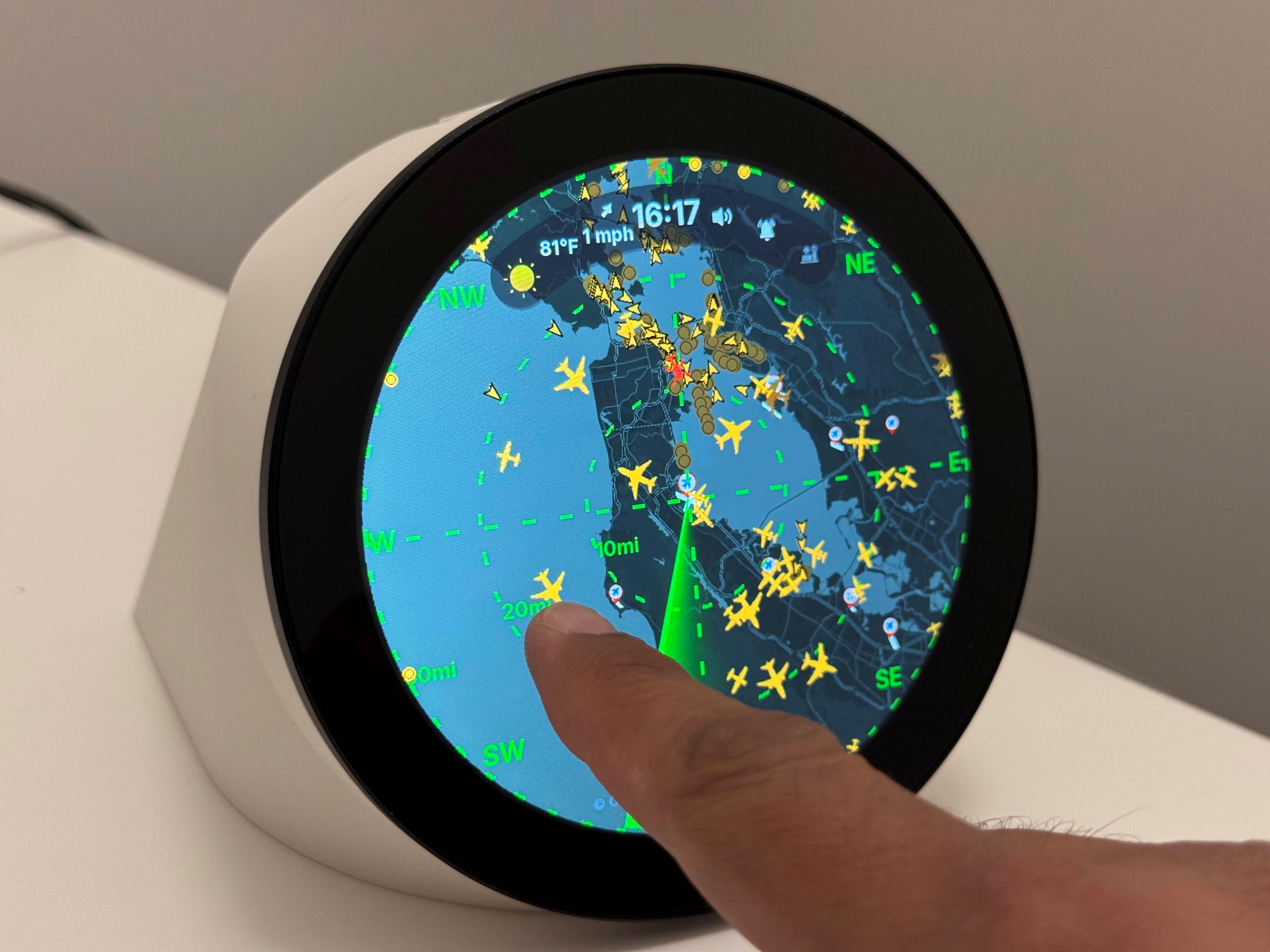
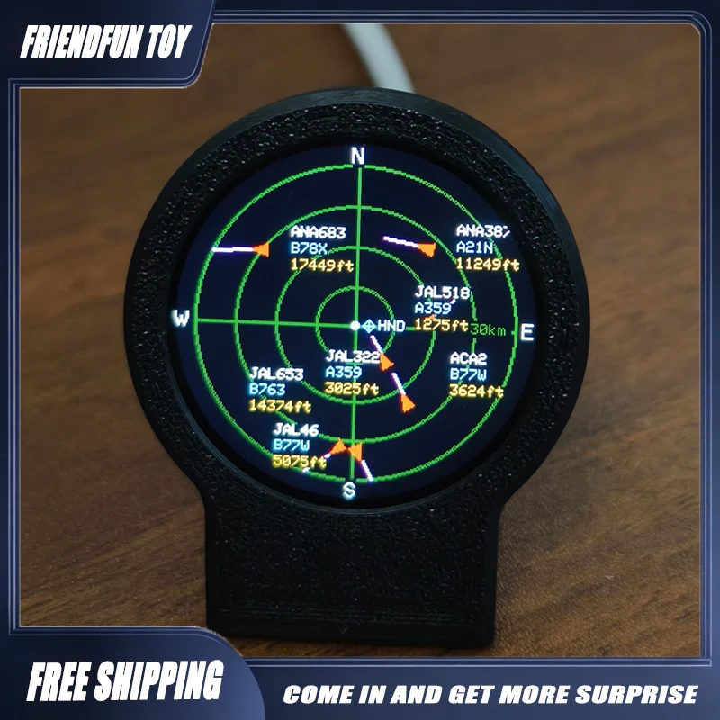
Switching to the 2D map provides an interactive radar display centered on your physical location. The map shows distance range rings, real-time aircraft velocity vectors, breadcrumb track histories, and airport approach paths.
3. Extended Range for Account Holders and Feeders
- Guest Tier (No Account Required): Offers out-of-the-box tracking for aircraft within a 30 nautical mile (NM) radius around your position.
- Free Registered Account: Expands the radar and AR tracking radius up to 150 nautical miles (NM), covering wide regional airspace.
- ADS-B Feeder Linking: Community members who run an ADS-B Exchange receiver station can link their feeder account to enjoy an ad-free experience, priority data streams, and instant feeder status cross-referencing.
4. Comprehensive Aircraft Telemetry
Tapping any aircraft reveals its full telemetry payload:
- Identification: Hex ICAO 24-bit transponder address, registration tail number, callsign, and flight number.
- Airframe Details: Manufacturer, model, ICAO type designator, and photos from community aviation databases.
- Flight Dynamics: True airspeed, ground speed, calibrated barometric altitude, geometric GNSS altitude, vertical rate of climb or descent (feet per minute), and magnetic heading.
- Navigation Status: Transponder squawk code (including emergency squawks:
7500hijack,7600radio failure,7700general emergency), selected autopilot altitude, and navigation mode flags.
5. Proximity Tracking and Custom Alerts
Set notifications for specific aircraft categories or tail numbers. When a tracked airframe enters your defined radar perimeter, TailVision alerts you so you can step outside with your camera or binoculars before the target leaves your visual horizon.
Technical Comparison: TailVision vs Other Flight Trackers
┌─────────────────────────────────────────────────────────────────────────┐
│                 Flight Tracking Applications Comparison                 │
├──────────────────────┬─────────────────┬─────────────────┬──────────────┤
│ Feature / Capability │ TailVision      │ Flightradar24   │ FlightAware  │
│                      │ (ADS-B Exchange)│ Mobile App      │ Mobile App   │
├──────────────────────┼─────────────────┼─────────────────┼──────────────┤
│ Primary Data Source  │ ADS-B Exchange  │ FR24 Network    │ FlightAware  │
│                      │ Unfiltered Feed │ + FAA SWIM Data │ + Terrestrial│
├──────────────────────┼─────────────────┼─────────────────┼──────────────┤
│ Augmented Reality    │ Yes (Native AR) │ Yes (AR Mode)   │ No           │
├──────────────────────┼─────────────────┼─────────────────┼──────────────┤
│ Military Airspace    │ 100% Unfiltered │ Heavily Blocked │ Heavily      │
│ & VIP Transparency   │ (No Censorship) │ (LADD / BARR)   │ Blocked      │
├──────────────────────┼─────────────────┼─────────────────┼──────────────┤
│ Free Tier Range      │ 30 NM (Guest)   │ Full Global     │ Full Global  │
│                      │ 150 NM (Account)│ (Filtered)      │ (Filtered)   │
├──────────────────────┼─────────────────┼─────────────────┼──────────────┤
│ Feeder Integration   │ Direct Feeder   │ Business Plan   │ Enterprise   │
│ & Ad-Free Unlock     │ Account Sync    │ Feeder Upgrade  │ Feeder Sync  │
├──────────────────────┼─────────────────┼─────────────────┼──────────────┤
│ MLAT Tracking        │ Open Community  │ Proprietary     │ Proprietary  │
│ (Non-ADS-B Targets)  │ Multilateration │ Multilateration │ MLAT         │
├──────────────────────┼─────────────────┼─────────────────┼──────────────┤
│ Target Audience      │ Planespotters,  │ General Public, │ Airlines,    │
│                      │ Hams, Monitors  │ Travelers       │ Commercial   │
└──────────────────────┴─────────────────┴─────────────────┴──────────────┘
The RF and Protocol Stack Behind ADS-B Exchange
Understanding the radio signals behind TailVision helps operators appreciate the engineering involved in tracking aircraft from the ground.
┌─────────────────────────────────────────────────────────────────────────┐
│                      Aviation RF Protocol Summary                       │
├──────────────────┬─────────────────┬─────────────────┬──────────────────┤
│ Protocol Layer   │ Frequency Band  │ Modulation Type │ Primary Data     │
├──────────────────┼─────────────────┼─────────────────┼──────────────────┤
│ 1090 MHz Mode S  │ 1090.0 MHz      │ Pulse Position  │ Airborne Pos,    │
│ Extended (1090ES)│ (L-Band)        │ Mod (PPM, 1MBps)│ Speed, ICAO Hex  │
├──────────────────┼─────────────────┼─────────────────┼──────────────────┤
│ 978 MHz UAT      │ 978.0 MHz       │ 2-Level CPFSK   │ General Aviation,│
│ (United States)  │ (UHF Band)      │ (1.0416 Mbps)   │ FIS-B / TIS-B    │
├──────────────────┼─────────────────┼─────────────────┼──────────────────┤
│ Multilateration  │ 1090 / 978 MHz  │ Time Difference │ Position of Non- │
│ (MLAT)           │ Synchronized RF │ of Arrival(TDOA)│ ADS-B Mode S Rigs│
└──────────────────┴─────────────────┴─────────────────┴──────────────────┘
1. 1090 MHz Mode S Extended Squitter (1090ES)
Most commercial aircraft broadcast on 1090 MHz using Mode S Extended Squitter pulses. Transmitters send 112-bit data packets at a 1-megabit-per-second rate. Each transmission carries the aircraft’s unique 24-bit ICAO address, GPS position, barometric altitude, airspeed, and flight ID.
2. 978 MHz Universal Access Transceiver (UAT)
In North America, general aviation aircraft operating below 18,000 feet frequently use 978 MHz UAT. UAT transmits aircraft position alongside ground broadcast weather (FIS-B) and traffic services (TIS-B).
3. Multilateration (MLAT)
Older aircraft and military planes often use basic Mode A/C or standard Mode S transponders without GPS broadcasting. ADS-B Exchange calculates their exact coordinates using Multilateration (MLAT). When at least four independent receiver stations capture the same transponder pulse with microsecond-accurate timestamps, server algorithms compute the target’s physical position via Time Difference of Arrival (TDOA).
Step-by-Step Guide: Getting Started with TailVision on Android
Follow these steps to set up TailVision on your Android device:
┌─────────────────────────────────────────────────────────────────────────┐
│                       Quick Setup Workflow                              │
└─────────────────────────────────────────────────────────────────────────┘
  [ Step 1: Install App ] ──► [ Step 2: Calibrate Sensors ] ──► [ Step 3: AR Sky Scan ]
                                                                       │
  [ Step 6: Set Alerts  ] ◄── [ Step 5: Link Feeder Station ] ◄────────┘
Step 1: Install from Google Play Store
Download and install TailVision by ADS-B Exchange directly from the Google Play Store on any Android device running modern Android firmware.
Step 2: Grant Permissions and Calibrate Sensors
- Open TailVision and grant Camera and Location (Precise GPS) permissions.
- Calibrate your device’s internal magnetometer: wave your smartphone in a slow figure-8 motion in an open area away from large metal structures or high-power magnetic fields.
Step 3: Test Augmented Reality Sky Tracking
- Walk outside with an unobstructed view of the sky.
- Tap the AR / Camera button on the main toolbar.
- Aim your smartphone lens toward an aircraft. TailVision will locate the aircraft in the ADS-B Exchange database and draw a target reticle over the aircraft on your display.
Step 4: Configure Radar Range and Filters
- Tap the Map tab to view your surrounding radar circle.
- Log in with your free ADS-B Exchange user account to expand your radius from 30 NM to 150 NM.
- Toggle layer filters to highlight military traffic, emergency squawks, or specific altitude bands.
Step 5: Link Your Feeder Station (Optional)
If you operate an ADS-B Exchange receiver station, navigate to Settings > Feeder Account and enter your feeder station key. This links your feeder statistics, removes advertising, and prioritizes your data queries.
Step 6: Configure Proximity Watchlists
Go to the Alerts menu and input callsign patterns or tail numbers you wish to monitor. TailVision will notify you whenever matching aircraft enter your local airspace.
How Radio Amateurs and SDR Hobbyists Can Feed ADS-B Exchange
Radio amateurs and SDR enthusiasts can easily contribute to the ADS-B Exchange network. Building a dedicated 1090 MHz receiver node expands global coverage and improves local MLAT accuracy:
┌─────────────────────────────────────────────────────────────────────────┐
│                 DIY 1090 MHz ADS-B Ground Station Build                 │
└─────────────────────────────────────────────────────────────────────────┘
                                     ┌────────────────────────────────────┐
                                     │  1090 MHz Collinear / PCB Antenna  │
                                     └─────────────────┬──────────────────┘
                                                       │ (Low-Loss RG-6 / LMR-240)
                                                       ▼
                                     ┌────────────────────────────────────┐
                                     │ 1090 MHz Bandpass Filter & LNA     │
                                     └─────────────────┬──────────────────┘
                                                       │ (SMA Connector)
                                                       ▼
                                     ┌────────────────────────────────────┐
                                     │ RTL-SDR / FlightAware Pro Stick +  │
                                     └─────────────────┬──────────────────┘
                                                       │ (USB 2.0 Port)
                                                       ▼
                                     ┌────────────────────────────────────┐
                                     │ Raspberry Pi / Orange Pi / Linux   │
                                     │ • readsb / dump1090-fa Decoder     │
                                     │ • tar1090 Local Web Dashboard      │
                                     │ • adsbexchange-feed.sh Client      │
└────────────────────────────────────┘- Antenna: Install an outdoor 1090 MHz omnidirectional antenna (such as a collinear coax array, ground plane, or PCB antenna) high above surrounding rooflines.
- SDR Receiver: Connect an RTL-SDR v4, FlightAware Pro Stick Plus (orange/blue), or Airspy Mini to a 1090 MHz bandpass filter and low-noise amplifier (LNA).
- Single-Board Computer: Plug the SDR into a Raspberry Pi, Orange Pi, or Linux mini PC.
- Feeder Client: Install the lightweight
readsbdecoder and run the official ADS-B Exchange feeder setup script:curl -L -o /tmp/axfeed.sh https://adsbexchange.com/feed.sh sudo bash /tmp/axfeed.sh - Join the Network: Once feeding, your station contributes raw Mode S and MLAT packets to the community. You can link your generated feeder UUID inside TailVision for an ad-free experience.
Frequently Asked Questions (FAQ)
What is TailVision?
TailVision is an Android flight-tracking app from ADS-B Exchange that combines augmented reality camera views with live radar data to identify civilian and military aircraft overhead in real time.
Does TailVision block or censor military and VIP flights?
No. TailVision uses ADS-B Exchange’s unfiltered global network, which does not participate in the FAA LADD program or censor public military, government, or private aircraft data.
How does the Augmented Reality (AR) mode work in TailVision?
TailVision uses your phone’s GPS, gyroscope, accelerometer, and compass to calculate the 3D line-of-sight vector to overhead aircraft, overlaying telemetry tags on your camera screen in real time.
What are the benefits of linking an ADS-B Exchange feeder account?
Linking a feeder account removes in-app advertisements, expands radar tracking range to 150 nautical miles, and provides direct access to your local station’s reception statistics.
Does TailVision require an external radio or SDR connected to my phone?
No. TailVision connects over your phone’s Wi-Fi or cellular data connection to fetch real-time aircraft positions directly from the ADS-B Exchange global aggregation servers.
Sources and Further Reading
- TailVision by ADS-B Exchange on Google Play Store
- ADS-B Exchange Official Website
- ADS-B Exchange Global Tracking Map
- ADS-B Exchange Feeder Setup Guide
- readsb – Lightweight ADS-B / Mode S Decoder on GitHub
- tar1090 – High Performance ADS-B Web Interface on GitHub
- RTL-SDR.com ADS-B Tracking and Decoding Tutorials
- HamRadio.my Amateur Radio and RF Engineering Articles
73 de 9M2PJU

Post Comment