APRSdroid NA7Q Edition: The Most Feature-Rich APRS Client for Android
For years, APRSdroid has been one of the most widely used APRS applications available for Android. It provides a practical way for Amateur radio operators to access the Automatic Packet Reporting System (APRS) from smartphones and tablets, whether through RF, APRS-IS, Bluetooth TNCs, or various radio interfaces.
While the official APRSdroid project remains a popular choice, the NA7Q Edition takes the application significantly further. Developed and maintained by NA7Q, this customized build introduces features that many APRS operators have requested for years, including full digipeating, two-way IGating, Mic-E support, advanced offline mapping capabilities, Bluetooth Low Energy support, DigiRig compatibility, and enhanced radio control functions.
The project is actively developed, and new functionality is continuously added. As a result, some features may still be under development or subject to change between releases.
Official project page:
https://www.na7q.com/aprsdroid
Downloading APRSdroid NA7Q Edition
Before installing the NA7Q version, it is recommended to remove any previously installed official APRSdroid version to avoid conflicts.
APRSdroid APK
Download the latest APRSdroid NA7Q build:
https://www.na7q.com/aprsdroid
Mobile HUD APK
The Mobile HUD companion application is available separately:
https://www.na7q.com/aprsdroid
The Mobile HUD application remains experimental and results may vary depending on device hardware and Android version. Current testing indicates that landscape orientation provides the best user experience.
Source Code
The project source code is available through GitHub:
One important note is that the APK does not include the Google Maps API. Users who require Google Maps functionality can build the application themselves and add their own Google Maps API key.
Android Storage Permissions and Offline Maps
Beginning with Android 11, Google introduced significant changes to storage access permissions. These changes impact applications that need direct access to map files stored on internal or external storage.
To enable offline maps in APRSdroid NA7Q Edition:
- Open APRSdroid Settings.
- Navigate to the OSM Maps section.
- Select Grant Storage Permissions.
- Approve the request for full file access.
Without this permission, APRSdroid cannot access locally stored mapping databases.
This step is required for Android 11 and newer devices.
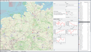
Offline Mapping Support
One of the largest improvements in the NA7Q build is its extensive offline mapping support.
The official APRSdroid implementation relies heavily on online map services. While suitable for urban environments with reliable cellular coverage, online maps become problematic during emergency communications, backcountry travel, search-and-rescue operations, and disaster response.
The NA7Q version addresses this limitation by supporting:
- MBTiles maps
- Mapsforge V3 maps
- OpenStreetMap offline databases
Users can operate entirely without an internet connection once maps are downloaded.
To use offline maps:
- Open Settings.
- Navigate to OSM Maps.
- Select OpenStreetMap.org as the map viewer.
- Enable Offline Mode.
- Choose your downloaded map file.
When Offline Mode is disabled, APRSdroid will continue using online OpenStreetMap servers.
Supported Map Formats
MBTiles
APRSdroid supports MBTiles databases that contain standard raster tiles stored as:
- PNG
- JPG
Vector MBTiles and PBF files are not currently supported.
This makes the application compatible with map sets generated for platforms such as:
- Gaia GPS
- OpenStreetMap tile downloads
- Custom mapping projects
Mapsforge V3
A newer addition to the project is Mapsforge V3 support.
Mapsforge maps provide vector-based rendering, resulting in:
- Smaller file sizes
- Faster rendering
- Improved zoom performance
- Better offline usability
This is particularly useful for operators carrying large regional maps on mobile devices with limited storage.
Downloading Maps
Obtaining suitable offline maps can often be the most challenging part of configuring APRS software.
To simplify this process, NA7Q provides several mapping tools.
OSM Map Maker for Windows
A Windows-based application that downloads OpenStreetMap data and generates APRSdroid-compatible map databases.
Download:
https://www.na7q.com/aprsdroid
Recommended usage:
- Enter a specific location.
- Examples:
- Portland, Oregon
- Oregon, USA
- Texas, USA
The more precise the location, the better the resulting map selection.
Python OSM Map Maker
A cross-platform alternative written in Python.
Compatible with:
- Windows
- Linux
- macOS
- Android
Download:
https://www.na7q.com/aprsdroid
This version provides greater flexibility and is useful for operators who prefer scripting or automation.
Multi-Map Maker
The Multi-Map Maker expands map generation by supporting additional map providers.
Available map sources include:
- Google Maps
- Google Satellite
- Google Terrain
- OpenStreetMap
- USGS
- USFS
- Canada Topographic Maps
- Thunderforest
- MapBuilder Light
- MapBuilder Dark
This allows operators to choose the most appropriate cartography for their operating environment.
Examples:
- Backcountry navigation may benefit from USFS maps.
- Search-and-rescue teams may prefer topographic layers.
- Mobile operators may prefer simplified road maps.
Download:
https://www.na7q.com/aprsdroid
Map Viewer
The Map Viewer utility allows users to preview available map styles before downloading large datasets.
This is particularly useful because:
- Not every map provider covers every region.
- Some providers restrict maximum zoom levels.
- Different styles emphasize different geographic features.
Download:
BBBike Mapsforge Generator
For operators who prefer Mapsforge vector maps, BBBike provides custom map generation.
Website:
https://download.bbbike.org/osm
Users can create custom vector map regions tailored to their operational area.
Understanding Zoom Levels
Map size increases dramatically as zoom levels increase.
NA7Q recommends:
- Zoom 13-14 for large states or regions.
- Higher zoom levels only when necessary.
Example:
A Washington State map generated at Zoom 15 can range between approximately 2 GB and 5 GB depending on the selected map source.
This is an important consideration for operators using limited storage devices.
Included World Map
For users who simply want to begin testing immediately, NA7Q provides a starter world map.
Coverage extends to approximately Zoom Level 6 and serves as a useful global reference layer.
World Map:
https://www.na7q.com/aprsdroid
Features Added Beyond Official APRSdroid
The biggest reason many operators switch to the NA7Q Edition is the extensive feature set.
These additions transform APRSdroid from a simple APRS client into a more complete mobile APRS platform.
Full Digipeater Support
One of the most requested capabilities is digipeating.
The NA7Q build supports:
- Direct digipeating
- Full digipeating
This enables Android devices to participate more actively in APRS RF networks.
Two-Way IGating
Most APRS applications provide limited APRS-IS connectivity.
NA7Q Edition supports:
- Receive from APRS-IS
- Transmit to APRS-IS
- Two-way IGating
This allows traffic to flow between RF and internet networks.
For operators building portable APRS infrastructure, this is a significant enhancement.
Flexible RF and APRS-IS Routing
Users can choose:
- RF only
- RF plus APRS-IS
- RF with IGating
This flexibility allows the station to be tailored for:
- Mobile operation
- Fixed stations
- Emergency deployments
- Field events
Mic-E Compression
Mic-E remains popular because of its compact packet format.
The NA7Q build includes:
- Mic-E encoding
- Mic-E status support
- Mic-E emergency status
This improves efficiency while maintaining compatibility with APRS infrastructure.
Standard APRS Compression
In addition to Mic-E, compressed position formats are supported.
Benefits include:
- Smaller packet sizes
- Reduced channel usage
- Improved network efficiency
Bluetooth Low Energy Support
Bluetooth Low Energy (BLE) support is nearing completion and has reached a stable stage of development.
Advantages include:
- Lower power consumption
- Improved battery life
- Better compatibility with modern hardware
This is particularly important for portable and mobile APRS operations.
DigiRig Support
DigiRig has become one of the most popular interfaces for Digital Amateur Radio communications.
The NA7Q build includes native DigiRig compatibility, simplifying setup for operators using:
- HTs
- Mobile radios
- Base stations
Radio Control Features
Expanded radio control support is included for various manufacturers.
Compatible systems include:
- Vero
- BTech
- Radioddity
Additional radio models may be supported depending on firmware and interface configuration.
Enhanced Station Information
Several usability improvements have been added.
The Station Viewer now displays:
- Speed
- Course
These fields provide immediate situational awareness when tracking mobile stations.
Hub Log Improvements
The Hub Log can sort stations by:
- Distance
- Most recently heard
This makes it easier to identify nearby activity and monitor local APRS traffic.
Metric and Imperial Units
Users may select their preferred measurement system.
Supported options include:
- Metric
- Imperial
This improves usability for international operators.
Hardware Acceleration Control
A toggle has been added to disable hardware acceleration.
This can help resolve compatibility issues on devices experiencing graphical rendering problems.
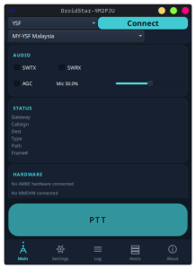
Mobile HUD
The Mobile HUD companion application aims to provide a heads-up display style interface for APRS operations.
Current status:
- Experimental
- Under active development
- Best used in landscape orientation
The concept is promising for:
- Mobile APRS tracking
- Navigation support
- Vehicle installations
As development continues, additional functionality is expected.
Development Roadmap
NA7Q continues to actively develop the project.
Planned enhancements include:
APRS Parser Improvements
More accurate packet decoding and interpretation.
Weather Readability
Improved display of APRS weather data.
Altitude Display
Altitude information added to the Hub Log.
Full Screen Mode
Better utilization of modern smartphone displays.
Integrated Mobile HUD Access
Direct access from the APRSdroid menu.
BLE Stability Improvements
Fixes related to startup crashes when no Bluetooth Low Energy device is selected.
APRS Query Commands
Support for commands such as:
?APRSM
and related APRS messaging queries.
Mic-E Cleanup
Additional refinements to Mic-E processing and status handling.
Beacon Type Selection
A simplified list-based interface for choosing:
- Mic-E
- Compressed
- Uncompressed
beacon formats.
Mic-E Emergency Alerts
Visual alerts for emergency status packets.
Path Tracking
Display whether stations were:
- Directly heard
- Digipeated
- Relayed
This will improve network visibility and troubleshooting.
Final Thoughts
APRSdroid NA7Q Edition represents one of the most ambitious APRS Android projects currently available. Rather than focusing solely on APRS messaging and tracking, the project expands the application into a comprehensive field communications platform.
The standout features are unquestionably:
- Full digipeating support
- Two-way IGating
- Offline MBTiles maps
- Mapsforge V3 support
- Mic-E functionality
- Bluetooth Low Energy compatibility
- DigiRig integration
- Advanced radio control
For operators who rely on APRS in remote areas, emergency communications, off-grid environments, search-and-rescue activities, or mobile deployments, these additions solve many of the limitations found in traditional APRSdroid installations.
Because development remains active, users should expect occasional bugs and unfinished functionality. However, the pace of development and the growing feature set make APRSdroid NA7Q Edition one of the most capable APRS applications available for Android today.
Resources:
Project Page:
https://www.na7q.com/aprsdroid/
Patreon:
https://www.patreon.com/na7q
GitHub:
https://github.com/na7q
BBBike Maps:
https://download.bbbike.org/osm/


Post Comment